National Hurricane Center Monitors Invests 94L and 95L: What Florida Residents Can Expect
The National Hurricane Center is tracking Invests 94L and 95L, neither of which poses a threat to Florida at present. Invest 94L is expected to mainly impact Puerto Rico and Hispaniola, while Invest 95L could affect Central America and Mexico. Forecasts indicate no significant developments for Florida in the near future, although a 50% chance for tropical development exists later in the month.
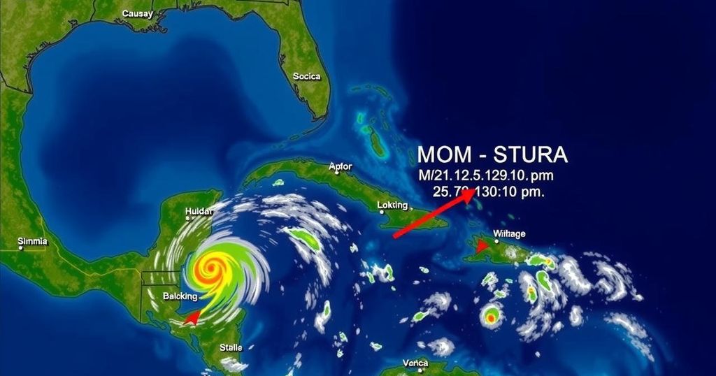
The National Hurricane Center is currently monitoring two weather disturbances, designated as Invest 94L and Invest 95L. Fortunately, neither of these invests poses a threat to Florida as they are expected to primarily affect Puerto Rico, Hispaniola, Central America, and Mexico with heavy rainfall. Invest 94L had shown some potential for development into Tropical Storm Nadine earlier this week but, currently, it is expected to move quickly west-northwest at approximately 20 miles per hour, affecting the northern Caribbean islands without significant development expected. Conversely, Invest 95L exhibits higher development potential with a 70 percent chance of becoming a short-lived tropical depression or storm. Regardless of whether it develops into a named storm, this system could bring considerable rainfall to Central America and southern Mexico this weekend. Moreover, forecasts from Colorado State University meteorologists suggest that there is no anticipated tropical development affecting Florida over the next 10 days. However, they indicate a 50 percent chance of tropical activity in the western Caribbean later this month, particularly by the end of October. In summary, while residents of Florida can feel reassured in the short term, meteorologists emphasize the importance of remaining vigilant as the hurricane season progresses, especially noting patterns of potential activity in late October and early November.
The Atlantic hurricane season runs from June 1 through November 30, with the peak occurring around September 10. The National Hurricane Center designates areas of interest for potential tropical development as “invests,” which are short for investigations. During this period, it is crucial for the public to stay informed about developments in the tropics, as these can have implications for weather patterns and storm activity. Historically, Florida has seen limited late-season hurricane threats, particularly significant hurricanes after late October. The National Hurricane Center utilizes advanced forecasting models and data collection methods, including specialized Hurricane Hunter aircraft, to monitor and predict storm behavior. The current conditions suggest that while immediate threats to Florida are low, continued observation is necessary as environmental factors fluctuate rapidly in the tropics.
In conclusion, while the immediate outlook for Florida regarding Invests 94L and 95L is positive, with no major threats detected, meteorological experts advise caution as the hurricane season nears its end. The potential for tropical development in the Caribbean towards late October may still warrant attention, urging residents to stay updated on weather conditions and advisories as they evolve.
Original Source: www.palmbeachpost.com


Post Comment