Unpredictable Hurricanes: The Case of Tropical Storm Oscar
Tropical Storm Oscar developed unexpectedly from a weak tropical wave to a Category 1 hurricane within a day, catching major forecasting models off-guard. Human reconnaissance efforts and satellite imagery played crucial roles in recognizing its development. Despite earlier predictions dismissing the storm’s potential, on-site analysis allowed forecasters to issue timely alerts as Oscar approached the Bahamas and Cuba, underscoring the limitations of current storm models, particularly for small systems.
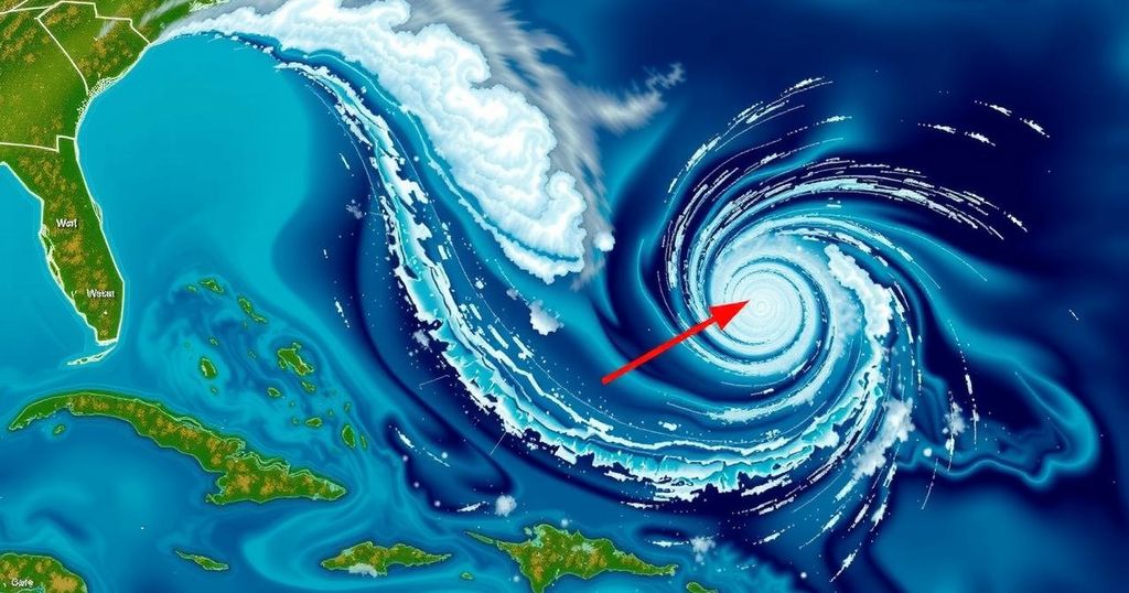
On Friday night, a disorganized tropical wave situated to the east of Puerto Rico was assessed to have merely a 10% probability of developing into a tropical storm. However, by midday Saturday, the system escalated to a Category 1 hurricane and was poised to impact the Bahamas. This rapid transition raised questions regarding the effectiveness of existing computer models, which failed to accurately predict the storm’s development. Experts indicated that the storm eluded the focus of major forecasting models, yet meteorologists and reconnaissance crews conducted vigilant monitoring that facilitated an early warning. Philippe Papin, the National Hurricane Center forecaster on duty that Saturday morning, observed a developing circulation while analyzing passive microwave imagery, a satellite technology designed to penetrate cloud cover and detect underlying storm structures. He remarked, “It became pretty clear that a small circulation was developing,” highlighting the necessity for a swift operational adjustment. By 11 a.m., the hurricane center had issued its initial forecast for what was now deemed Tropical Storm Oscar, issuing a specific trajectory that indicated a landfall on the Bahamas and Cuba. This compelled the Bahamas to initiate a tropical storm warning. Concurrently, a team of Hurricane Hunters quickly mobilized and departed from St. Croix to gather aerial data. Upon their assessment, the airborne reconnaissance team revealed a significantly more organized system than what had been detected days earlier. Tropical-storm-force winds were not recorded until the aircraft was within ten nautical miles of the storm’s center, as indicated by Papin, signifying the system’s unexpected robustness. By 2 p.m. Saturday, Tropical Storm Oscar was officially classified as Hurricane Oscar, marking one of the smallest hurricanes recorded in the Caribbean and leaving the affected regions with less than 24 hours to prepare for impact. As highlighted by Papin, “The typical time for issuing a watch is 48 hours of lead time. This was more like 12 to 24 hours. Obviously that is sub-optimal.” Hurricane Oscar subsequently made landfall on Great Inagua Island in the Bahamas and later on Cuba’s eastern coast. Initially, forecasting models had identified the system over a week prior and suggested a reasonable likelihood of it forming into a tropical entity. Nevertheless, a surge of dry air seemingly dismantled its potential, leading models to prematurely dismiss its development. By the time reconnaissance was conducted, many models exhibited no predictions of storm formation in the vicinity for the following week. Phil Klotzbach, senior research scientist at Colorado State University, articulated that, “I think the models just had a hard time resolving the circulation before they got the recon in there. It’s not like the models didn’t have signals, they had them and then it killed them off.” As data from the reconnaissance flight was integrated into forecasting models, clarity regarding Oscar’s size emerged, revealing winds extending a mere five nautical miles from the center of the storm. Despite Hurricane Oscar’s diminutive scale compared to other storms, its classification proves particularly challenging for forecasting models. Historical records demonstrate that, although small, the storm’s size and intensity create forecasting difficulties, as articulated by Klotzbach: “These small storms are tricky.”
The rapid progression of Tropical Storm Oscar into a hurricane exemplifies the challenges faced in storm forecasting, particularly regarding smaller systems. On occasions, systems may exhibit minimal initial threat levels, only to undergo unexpected strengthening. Understanding the evolution of Oscar underscores the need for continuous improvements in meteorological modeling and data collection methods to enhance forecast accuracy. The reliance on both advanced technologies and human expertise demonstrates the complexity of effectively predicting hurricane developments, especially as conditions change rapidly.
In summary, the unexpected evolution of Tropical Storm Oscar into a hurricane illustrates significant limitations within current forecasting models. Human observation and data collection proved instrumental in issuing timely warnings, emphasizing the importance of continual advancements in meteorology to enhance predictive capabilities for rapidly developing weather systems. Ultimately, the case of Hurricane Oscar serves as a cautionary tale highlighting the unpredictability of smaller storm systems and the vital role of reconnaissance in effective storm forecasting.
Original Source: www.miamiherald.com


Post Comment