Tropical Storm Sara Forms and Threatens Honduras Amidst an Active Hurricane Season
Tropical Storm Sara has formed over warm waters in the Western Caribbean, posing a significant threat to northeastern Honduras with expected rainfall of 10 to 20 inches. The 2024 Atlantic hurricane season has been notably hyperactive, with 18 named storms recorded. Historical precedents of devastation from previous hurricanes underscore the potential impact of Sara, particularly concerning flooding and migration patterns. Meteorological forecasts suggest a complex trajectory potentially affecting the U.S. Gulf Coast next week.
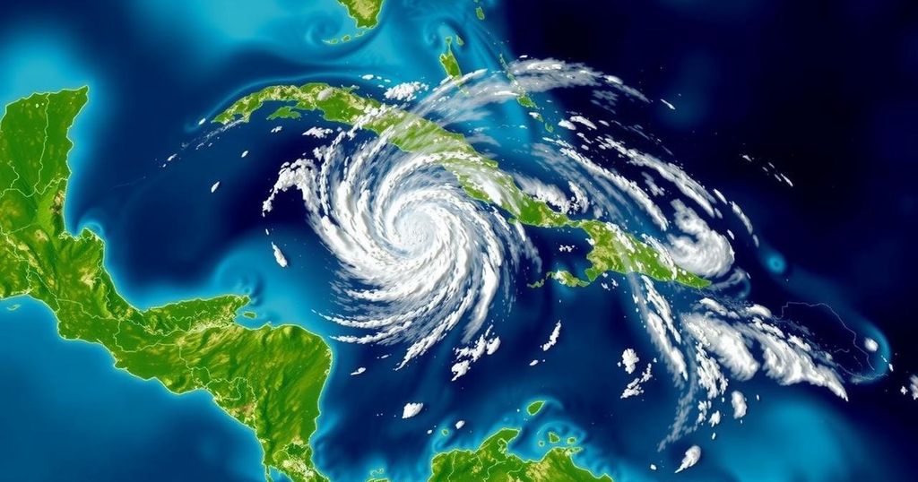
Tropical Depression 19 transitioned to Tropical Storm Sara within nine hours of formation over exceptionally warm waters in the Western Caribbean on November 14, 2024. This event marked the 18th named storm of the Atlantic hurricane season, which has had 11 hurricanes and five major hurricanes to date, exceeding the average season of 14 named storms. The season has been classified as hyperactive by the Colorado State University’s forecast criteria, with a cyclone energy index of 160, representing a 31% increase over average levels. Notably, this is the first use of the name Sara since its addition to the Atlantic lists following Hurricane Sandy in 2012. As of 1 p.m. EST on Thursday, November 14, Sara was located approximately 50 miles northeast of the Nicaragua/Honduras border, moving southwestward at 12 mph with sustained winds around 40 mph. Landfall in northeast Honduras is anticipated late Thursday, with predictions of 10 to 20 inches of rain potentially causing devastating flooding. Rainfall records show Trujillo, Honduras, reported over 3 inches within 30 hours, indicative of the storm’s rainfall capacity. The recent surge in storm activities in the Atlantic, particularly from late September to November, sets a record for this timeframe according to Phil Klotzbach. Meteorological forecasts indicate that while Sara is expected to maintain a westward trajectory under a ridge of high pressure, it may also veer northwest over the Yucatan Peninsula next week. Given the ongoing land interaction, the atmospheric conditions are favorable for intensification or degradation to tropical depression status, with the mountainous terrain of Honduras complicating Sara’s organization, further increasing the risk of flash floods and landslides. A change in trajectory later may take Sara over cooler waters, significantly mitigating any threat to the U.S. Gulf Coast, although residual effects could lead to significant rainfall in Florida next week. Honduras has a troubling history with late-season tropical cyclones, having experienced catastrophic events like Hurricane Mitch in 1998 and more recently Hurricanes Eta and Iota in 2020, both of which brought widespread devastation. These events collectively caused significant economic losses, leaving a sizeable gap in recovery funding that the Honduran government could not cover. Recent reports indicate that thousands of lives were lost, infrastructure was severely damaged, and the Honduran economy was drastically affected, with over 40% of the population experiencing direct impact from these hurricanes. Consequently, there has been a marked increase in migration from Honduras to the U.S. in the aftermath of these storms, primarily fueled by environmental factors such as hurricanes and ongoing climate change.
The phenomenon of tropical storms and hurricanes is significantly influenced by a combination of warm ocean waters and atmospheric conditions. The Atlantic hurricane season traditionally stretches from June to November, with peak activity occurring between late August and early October. However, occurrences such as Tropical Storm Sara demonstrate the capacity for storms to develop late in the season, especially in the context of rising global temperatures that have linked climate change to increased frequency and intensity of tropical cyclones. Honduras, geographically vulnerable due to its mountainous terrain and socioeconomic conditions, has faced prolonged challenges in the wake of past hurricanes, leading to disastrous flooding and mudslides. Historical data underline a pattern of intensified rainfall linked to tropical storms, which has not only resulted in immediate fatalities but has also exacerbated long-term economic instability and migration issues. Recognizing these patterns provides necessary context for evaluating the impact of new storms such as Sara, particularly as communities continue to rebuild from previous disasters. As climate change progresses, understanding the relationship between storm formation and environmental factors becomes vital in preparing for future events and mitigating their impact on vulnerable populations.
In summary, the emergence of Tropical Storm Sara as a late-season cyclone poses significant risks to northern Honduras, with expectations of extreme rainfall leading to potential catastrophic flooding. Historical precedents in the region serve as a stark reminder of the human and economic toll associated with such weather events. The current active Atlantic hurricane season reflects broader climate trends, raising concerns regarding the future welfare of communities in vulnerable areas. Comprehensive disaster management and recovery strategies will be essential in mitigating impacts and addressing the underlying vulnerability of affected populations.
Original Source: yaleclimateconnections.org


Post Comment