Tropical Cyclone Bheki Approaches Mauritius and Réunion: Current Status and Forecasts
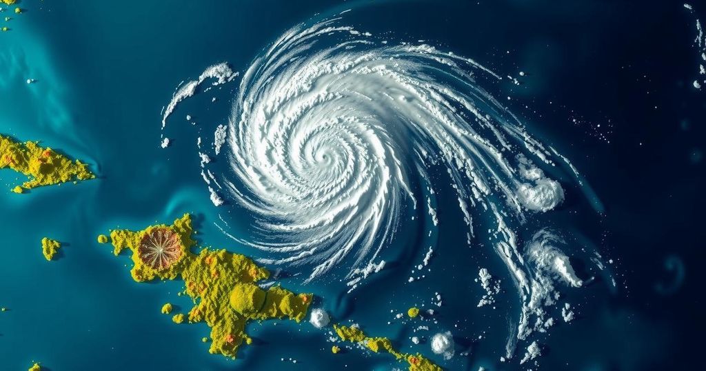
Tropical Cyclone Bheki passed near Mauritius and Réunion on November 21, 2024, with winds of 74 km/h (46 mph) and moderate rains. Although it is expected to strengthen temporarily, forecast models suggest weakening after 12 hours. Significant rainfall is anticipated across both islands until November 25, marking Bheki as the second named storm of the season.
On November 21, 2024, Tropical Cyclone “Bheki” passed in close proximity to the islands of Mauritius and Réunion, producing moderate rainfall and registering sustained winds of 74 km/h (46 mph). Despite its tropical characteristics, the cyclone’s warm core is limited to a shallow depth below 700 hPa, while sea surface temperatures hover around a marginal 26 °C (78.8 °F). Notably, the system has encountered strong upper-level westward winds that have affected its trajectory and intensity predictions.
As of 09:00 UTC on November 22, Bheki had significantly slowed and stalled southwest of La Réunion, primarily due to the influence of local topography. The cyclone is anticipated to resume a southwestward movement, gradually accelerating as it progresses west of the Mascarene High, a high-pressure system. Initial satellite analyses indicate a resurgence of convective activity near the storm’s center, suggesting potential for additional strengthening, according to numerical weather models. The HWRF model predicts that Bheki could intensify to approximately 83 km/h (52 mph) within the next 6 to 12 hours from 09:00 UTC on November 22, while the HAFS-A model forecasts a more stable intensity prior to a swift degradation.
Forecasters expect that Bheki will continue to produce moderate rainfall over Mauritius, while similar conditions are anticipated for Réunion from November 22 to 25. This weather system emerged as the second named storm of the 2024/25 South-West Indian Ocean cyclone season. Initially, Bheki formed on November 14 and progressed quickly, achieving status as an Intense Tropical Cyclone on November 18, thereby marking it as the strongest November cyclone on record in this region, based on sustained wind speeds.
The South-West Indian Ocean cyclone season is a climate phenomenon characterized by the formation of tropical cyclones, which are intense storm systems occurring over warm ocean waters. The 2024/25 season has already indicated significant storm activity, with Tropical Cyclone Bheki exemplifying the impact of environmental conditions such as sea surface temperatures and wind patterns on cyclone development. Understanding these dynamics is key for predicting the behavior of such weather events, especially their potential threats to landmasses like Mauritius and Réunion.
In summary, Tropical Cyclone Bheki poses a continued moderate threat to the island regions of Mauritius and Réunion, with potential for fluctuating strength due to dynamic meteorological influences. While current predictions suggest possible intensification in the near term, unfavorable atmospheric conditions may lead to a subsequent weakening. It is crucial for residents and local authorities to remain vigilant as the cyclone progresses and its impact becomes clearer.
Original Source: watchers.news


Post Comment