Virginia Faces Major Winter Storm From Late Sunday to Monday
Virginia is preparing for a significant winter storm affecting the state from late Sunday into Monday, with winter storm watches in place. Initial snow may mix with sleet and freezing rain, particularly in southern areas. Precipitation types will vary based on the storm track, with potential icy conditions persisting into the following week.
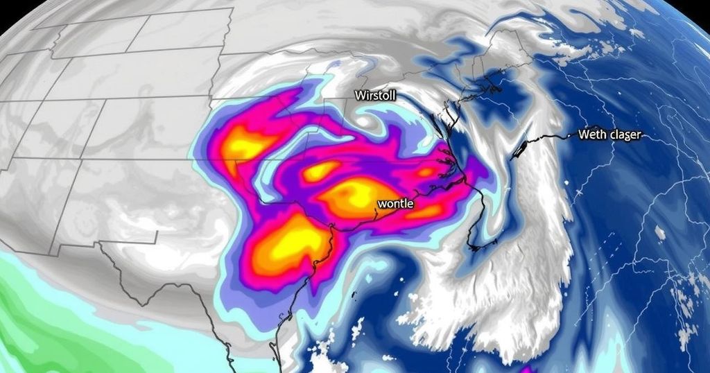
A significant winter storm is anticipated to impact Virginia from late Sunday through Monday, prompting winter storm watches for central and northern regions. As the storm approaches, some snow may evaporate before hitting the ground, yet it is expected to begin accumulating by mid-evening, continuing through midnight. As warmer air moves in, the snow will transition into sleet and potentially freezing rain, particularly in the southern areas. However, areas north of Interstate 64 may still experience a wintry mix. On Monday, temperatures will rise, possibly changing precipitation to rain in the metro area while northern parts may still see snowfall. The track of this system will determine precipitation types and accumulations, which could vary dramatically in a short distance. After the storm, icy conditions are likely to persist into Tuesday, with temperatures staying near freezing, leading to a thaw-freeze cycle throughout the week. Further updates will be made available as the storm progresses.
This article addresses an impending winter storm forecasted to hit Virginia, detailing the types of precipitation expected and potential impacts on roads and surfaces. It discusses the atmospheric conditions that influence this storm, such as the interaction between cold and warm air masses, and how these dynamics can lead to varied weather conditions across different regions. Understanding the forecast informs citizens about safety precautions and potential disruptions due to icy and snowy roads.
In summary, residents of Virginia should prepare for a winter storm that will bring a mixture of snow, sleet, and possibly freezing rain from late Sunday into Monday. Awareness of the potential for hazardous conditions, especially on untreated surfaces, is essential. The storm’s exact path will significantly influence the types of precipitation received in various areas of the state, and ongoing updates are anticipated. The week following the storm is also expected to pose challenges due to lingering icy conditions, emphasizing the need for caution while traveling.
Original Source: www.wtvr.com


Post Comment