Weather
76, ADIRONDACK, AFRICA, ATLANTIC, BRANDON BUCKINGHAM, BULGARIA, CANADA, CHICAGO, CLEVELAND, CLIMATE, DAKOTAS, DETROIT, EUROPE, FORECAST, GREAT LAKES, GREEN, GREEN AND WHITE MOUNTAINS, INDIANA, MARYLAND, METEOROLOGY, MICHIGAN, MID, MIDWEST, MONTANA, NEW ENGLAND, NORTH, NORTH AMERICA, NORTH CAROLINA, NORTHEAST, OHIO, OHIO VALLEY, PENNSYLVANIA, PLOWA, RAIN, SOUTH AFRICA, TENNESSEE, TENNESSEE VALLEY, THUNDERSTORMS, UNITED STATES, UPPER PENINSULA, VIRGINIA, WEATHER, WEST VIRGINIA, WHITE, WISCONSIN
Marcus Chen
0 Comments
Severe Winter Storms to Disrupt Travel and Cause Power Outages Across Midwest and Northeast
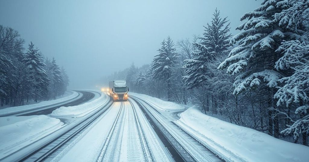
A severe winter storm will impact the Midwest and Northeast, bringing snowfall, freezing rain, and sleet, leading to hazardous travel and increased power outage risks. Major urban areas like Chicago and Detroit are particularly vulnerable to significant ice accumulations. Thunderstorms will also develop in the South, with a follow-up storm expected by the weekend, raising further concerns for residents.
A severe winter storm is poised to cause hazardous travel conditions across the Midwest and Northeast, along with an increased risk of power outages. Precipitation, including snow, freezing rain, and sleet, will affect a wide area from February 5 to 6, particularly impacting air and road travel. Strong winds following the storm may result in significant ice and snow accumulation on trees and power lines, exacerbating the risk of outages.
In the lead-up to the storm, snowfall accumulations are expected to advance eastward from Montana and the Dakotas into parts of the Great Lakes and northern Midwest. The storm will progress offshore on Thursday, bringing the heaviest snowfall to mountainous regions, while rain and potential thunderstorms are predicted in the Tennessee Valley and North Carolina coastline. Rain may also produce hail and strong winds.
An incoming mixture of moisture and cold air will create a swath of hazardous conditions, particularly in metropolitan areas such as Chicago, Detroit, and Cleveland, where freezing rain may accumulate significantly. The highest ice accumulations are anticipated Wednesday night into Thursday morning, presenting challenges for morning commuters along major interstates. The I-95 corridor will see less snow, but the region requires monitoring for potential precipitation type changes.
As temperatures rise throughout Thursday, any initial snowfall in areas such as New York City is expected to transition to sleet before ultimately changing to rain. This warmer air will facilitate melting of any accumulated snow. Additionally, thunderstorms are forecasted to develop in the Tennessee Valley, posing risks of hail and intense gusts of wind, particularly in areas like Nashville and Jackson.
Following this storm, strong winds exceeding 40 mph are predicted from Wisconsin to Michigan, leading to possible visibility issues due to blowing snow. On Friday, winds are expected to intensify further across regions in New England. Furthermore, meteorologists warn of another impending storm to affect the Northeast over the weekend, bringing similar winter weather impacts as the current storm moves on.
The article discusses a significant winter storm affecting the Midwest and Northeast of the United States, expected to bring various precipitation types, including snow, ice, and rain, over a defined period. This inclement weather raises concerns for travel safety and potential power outages. The dynamics of shifting temperatures and humidity levels will further influence the type and intensity of precipitation across different regions, especially in major urban areas. Meteorological experts emphasize the need for monitoring conditions closely as the storm unfolds, particularly for commuters.
The impending storm poses serious travel and safety risks across large portions of the Midwest and Northeast, characterized by various hazardous winter conditions. Residents are advised to prepare for possible power outages and treacherous travel as these weather systems develop, particularly in urban centers. Meteorologists continue to monitor the situation closely, forecasting follow-up storms that could further impact the same regions over the coming days.
Original Source: www.accuweather.com


Post Comment