Weather
ACCUWEATHER, ASIA, BRIAN HURLEY, CLIMATE, EAST, HURLEY, JAPAN, JONATHAN ERDMAN, LOWER 48, MIDWEST, NORTH AMERICA, OHIO VALLEY, PLAINS, PREDICTION CENTER, RAIN, SCIENCE, THUNDERSTORMS, U. S, UNITED STATES, USA, USA TODAY, WEATHER, WEATHER FORECAST, WEATHER PREDICTION CENTER, WEATHER PREDICTION CENTER METEOR, WEATHER. COM, WEST
Stella Nguyen
0 Comments
Omega Block Dominates U.S. Weather Patterns, With No Change in Sight
An omega block is affecting U.S. weather, causing cool conditions in some areas while others enjoy warmth. This pattern could persist through next weekend, as forecasted by meteorologists. A change to a zonal flow is needed to break the stagnant weather conditions, but no imminent shifts are expected.
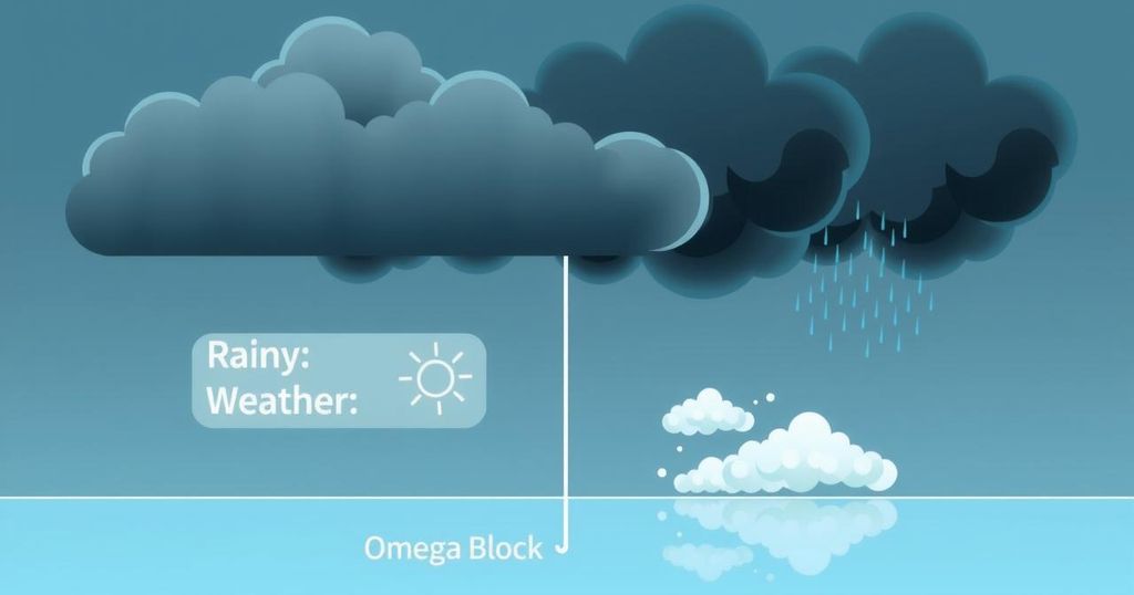
An omega block has firmly taken hold of the weather patterns across much of the United States. This stationary system, resembling the Greek letter omega (Ω), disrupts the usual west-to-east jet stream flow, resulting in stagnant weather. The East and West are experiencing cool, showery conditions while the north-central U.S. enjoys mild, clear weather. However, forecasters do not anticipate any shifts in this pattern anytime soon.
Meteorologists are expressing concerns about the longevity of the omega block. Weather Prediction Center’s meteorologist, Brian Hurley, stated that this pattern is likely to persist at least until next weekend, possibly longer. “We could be stuck for a while,” Hurley told USA TODAY. The blocking weather pattern is a classic April-May occurrence, especially when low-pressure areas become disconnected from the main jet stream flow.
Jonathan Erdman, a meteorologist at Weather.com, explained the omega block’s mechanics. As he noted, tracing the jet stream’s path resembles the letter omega, and this pattern impedes the typical west-to-east movement of weather systems. It acts much like a rock obstructing a stream, compelling the flow to veer around it. Consequently, regions experience locked-in weather, with some enduring chillier, unsteady conditions, while others bask in prolonged warmth and dryness.
As for current conditions, this omega block is indeed causing varied weather. The East and West coast regions are under a blanket of cool, damp, and cloudy skies, while the north-central U.S. experiences mostly sunny and mild weather. The Weather Prediction Center recently noted that the blocking pattern continues to shape the Lower 48’s weather, with a gradually moving upper low over the Ohio Valley and another over the Southwest.
High-pressure areas, or ridges, are usually associated with fair weather, but the omega block holds mixed results for temperatures. This week will likely bring significant temperature fluctuations, as stated by the Weather Prediction Center.
So, how long can we expect this omega block to persist? Hurley suggests that we might see a temporary easing of the pattern by the middle to the end of this upcoming week, only to have it re-establish by next weekend. Looking ahead to next week—on May 12—a more closed upper low circulation may impact the Mississippi Valley and the West Coast, leading to weather conditions similar to those currently observed.
Breaking the omega block for good will require a transition to a zonal flow of air where weather systems can traverse the country more freely. “But, we’re not really seeing that now,” Hurley cautioned.
The current omega block is significantly influencing weather patterns across the United States, keeping temperatures varied and conditions stagnant. Experts predict that this situation may linger at least until next weekend, with occasional temporary shifts. Transitioning to a more typical zonal flow is essential for breaking the pattern, although forecasts do not indicate this occurring in the near future. Residents should prepare for ongoing fluctuations in weather in the weeks ahead.
Original Source: www.usatoday.com


Post Comment