Heavy Snow Expected This Weekend in Glacier Park
Montana is experiencing warm spring weather, but a key shift is on the way. Afternoon thunderstorms are anticipated across the state, leading to heavy snowfall in Glacier National Park this weekend. A winter storm watch is in effect, warning of up to a foot of snow in higher elevations. Rainfall is also expected in northwest Montana as temperatures drop significantly after this weekend.
Montana is seemingly experiencing an unusual spring day as temperatures soar into the mid 70s to mid 80s. Skies across much of the state remain clear, save for some thunderstorms brewing in the northeast near the Canadian and North Dakota borders. Winds are fairly calm, gusting between 5 to 15 mph, with some areas experiencing gusts reaching as high as 30 mph in places like Jordan. It has certainly been a lovely day under the influence of high pressure, bringing warmth to the region.
However, that pleasant weather is about to take a turn. A moist flow from the southwest is expected to return tomorrow, which will trigger afternoon thunderstorms in southwestern Montana. Some of these storms may pack a punch, leading to potential hazards in that region. As Friday approaches, the rest of the state could also see showers and strong storms, especially in the later hours.
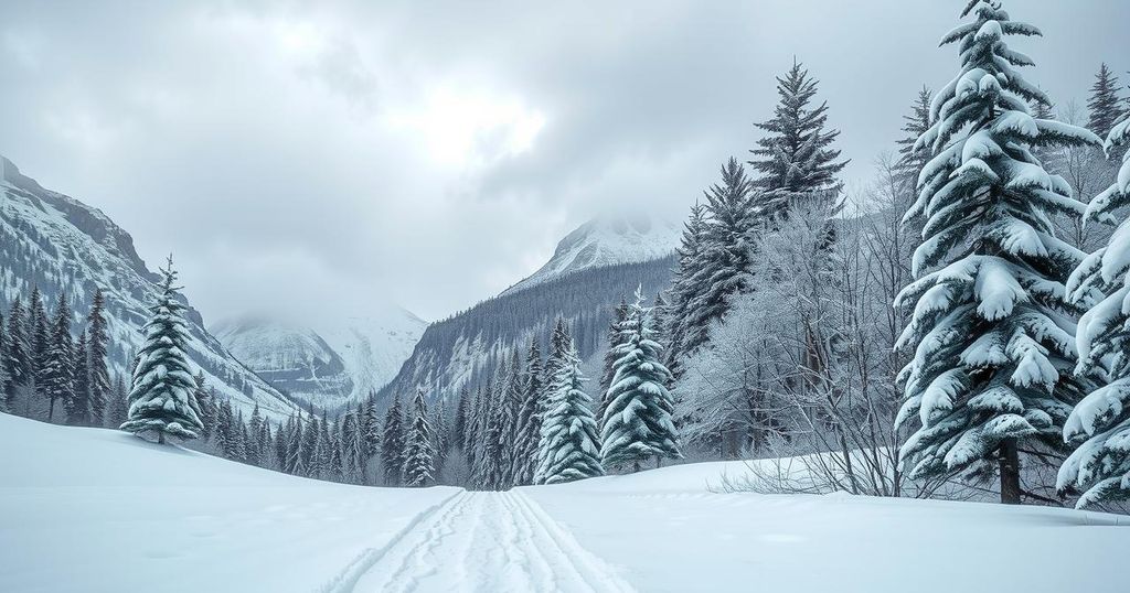
Looking ahead to the weekend, a low-pressure trough forming near Seattle is on course to sweep through Montana. As a result, temperatures will drop significantly, particularly in the western regions come Saturday. Glacier National Park is bracing for significant snowfall, with a winter storm watch already in effect from Saturday afternoon until Sunday morning. Reports suggest that the park could see up to a foot of snow above 6,000 feet, and even up to four inches at lower elevations around 4,000 feet, including the key tourist area of Logan Pass.
Alongside the snowfall, heavy rainfall is expected in northwest Montana, particularly in Flathead and Lincoln Counties, where accumulations of two to four inches are anticipated. Tonight, expect balmy lows in the upper 40s and 50s, but a stark change is on the horizon as tomorrow’s highs are predicted to reach the mid 80s to mid 90s before cooler air settles in on Sunday, when temperatures will only reach the 50s and 60s.
In conclusion, Montana’s weather is set to shift dramatically this weekend, following a warm sunny day. With thunderstorms expected on Friday, Glacier National Park is preparing for heavy snow and dramatically cooler temperatures as a winter storm watch is in effect. Visitors to the park should stay informed and be ready for changing conditions as the weekend approaches.
Original Source: www.montanarightnow.com


Post Comment