Inland Northwest Weather Update: High Pressure, Fog, and Cold Temperatures
The upcoming weather in the Inland Northwest will be dominated by a high-pressure ridge, bringing cold temperatures and morning fog. Daytime highs are expected to be in the low 30s, with possible light snowfall towards the end of the week. Overall, the region will experience stable yet chilly weather conditions, requiring residents to remain vigilant.
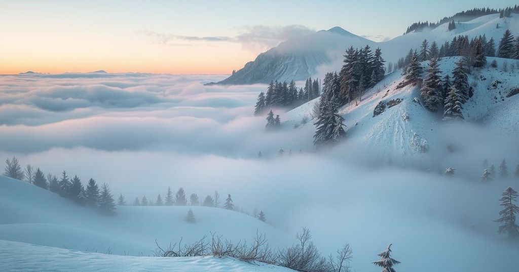
A familiar weather pattern has returned to the Inland Northwest following the weekend showers. A ridge of high pressure is expected to settle over the region on Monday and Tuesday, resulting in a temperature inversion. This phenomenon will likely lead to the development of morning fog, with minimal temperature fluctuations between day and night. Overnight temperatures are projected to remain in the upper 20s, while daytime highs will hover in the low 30s. As the week progresses, sporadic showers may occur, including potential light snowfall at lower elevations by the week’s end.
The region’s forecast indicates consistent cloud cover throughout, with a slight chance of flurries or snow showers. The humidity level is exceptionally high, at nearly 98%, and winds will be light and variable, contributing to the cold yet stable weather conditions. The likelihood of snow accumulations increases toward the week’s end, with expected precipitation possibly reaching up to three inches in some areas.
Residents are encouraged to remain prepared for reduced visibility due to fog and the potential challenges associated with colder temperatures and light snowfall. The overall weather trajectory suggests a continuation of cloudy skies punctuated by occasional snow, particularly on Thursday and Friday. Weather enthusiasts and locals are advised to stay updated with the latest forecasts as conditions develop.
The Inland Northwest is characterized by a diverse climate influenced by various atmospheric patterns. Inversions, which occur when warmer air traps cooler air at lower elevations, can lead to foggy conditions. This weather phenomenon is particularly common in winter months and can affect the region’s temperature, visibility, and potential precipitation. With the arrival of high pressure, forecasts indicate a distinct lack of variability in daytime and nighttime temperatures, a phenomenon that may lead to prolonged fog and chill in the air. Moreover, as low-pressure systems approach the region, they might bring about sporadic precipitation, including snow, which can complicate travel and outdoor activities. Understanding these weather dynamics helps residents prepare for changing conditions. Meteorologists utilize various data sources to predict these weather patterns accurately, ensuring that the community remains informed about potential weather-related hazards.
In summary, the Inland Northwest is experiencing a return to high-pressure weather conditions, leading to persistent fog and consistently cold temperatures. This pattern will result in minimal temperature variations and increased chances of precipitation in the form of snow towards the end of the week. As residents navigate these conditions, it is crucial for them to remain informed and prepared for the potential challenges posed by the weather. Continued monitoring of forecasts will be essential for safe planning and travel in the coming days.
Original Source: www.khq.com


Post Comment